27 March 2024
To solve environmental problems in our rivers, lakes, estuaries and coastal waters, hydrodynamic models rely on a range of boundary condition forcings. For a complex model, there may be hundreds of necessary boundary conditions, each requiring input data for multiple parameters.
To help with model development TUFLOW have produced a suite of ‘Get Tools’ to help generate three common model boundary condition inputs: the astronomical tide (using 'Get Tide'), meteorological/climate (using 'Get Atmos'), and ocean circulation variables (using 'Get Ocean'). Each of the Get Tools select and download relevant boundary condition data, merge them together and write out TUFLOW FV compatible boundary condition data and associated control files. Each tool is run within our TUFLOW FV Python Toolbox for a seamless workflow.
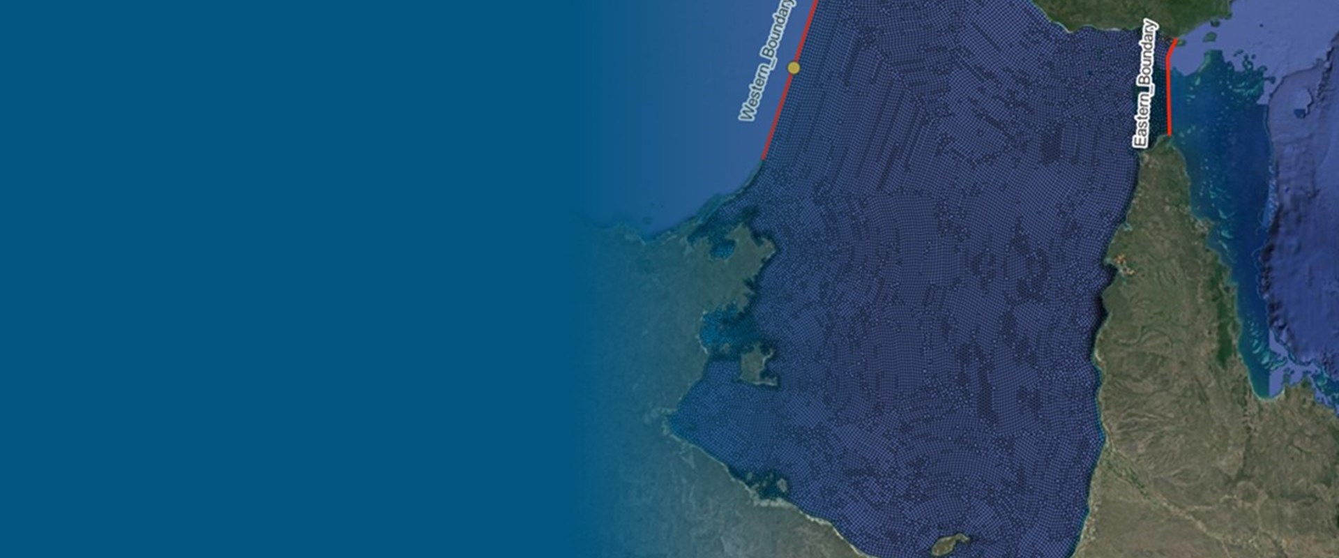
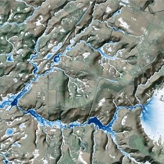
Accompanying the Get Tools are new TUFLOW FV Wiki pages that provide step-by-step instructions as to each tool's usage (see Get Atmos, Get Ocean, Get Tide). The boundary conditions produced in each tutorial are utilised by an example model of the Gulf of Carpentaria (Figure 1). This example model also forms the basis for the TUFLOW FV Coastal Example Models which you can download and run licence free, allowing you to try out or test alternative coastal model configurations.
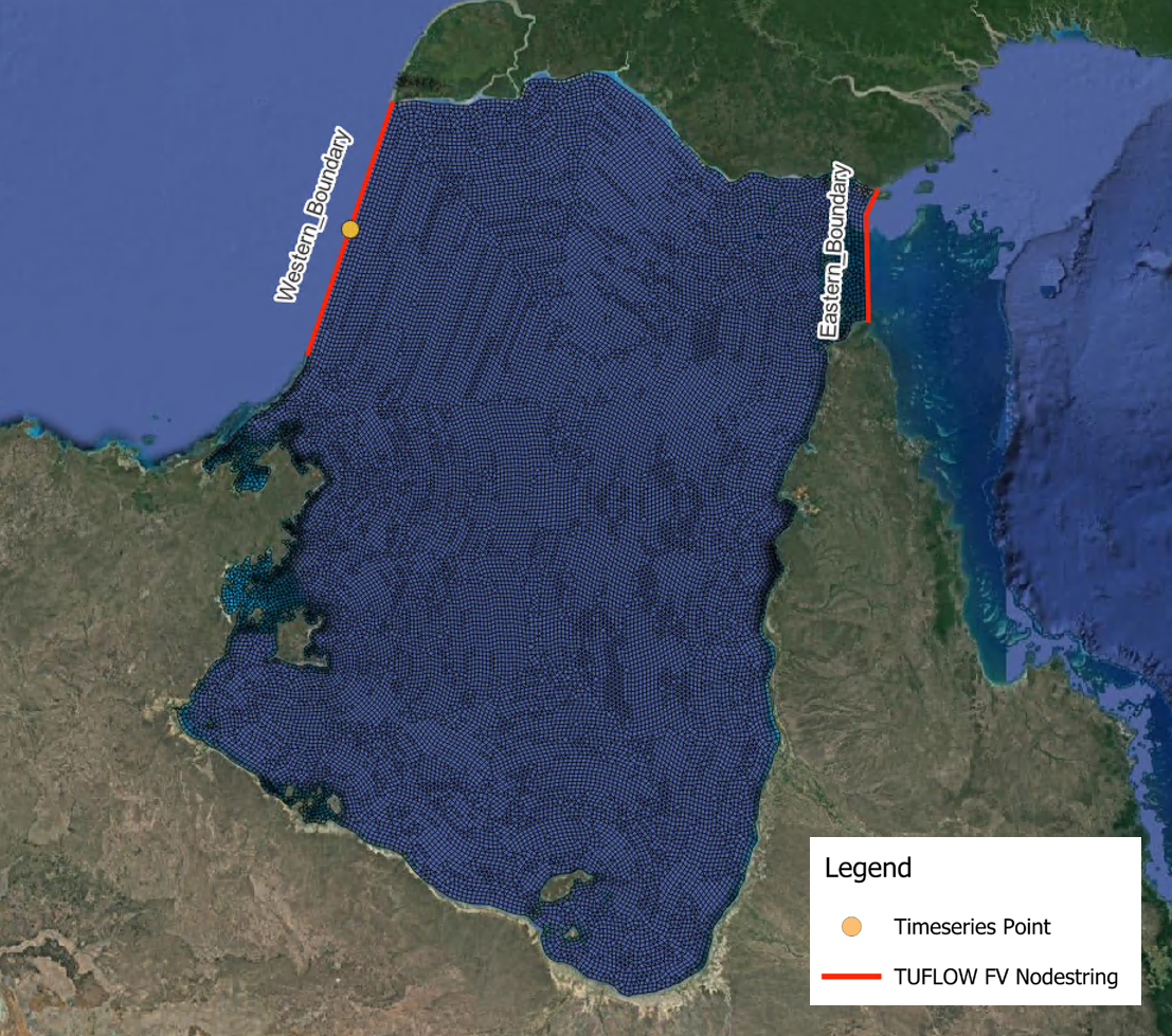
Figure 1: Gulf of Carpentaria model extent displaying the model mesh and open boundaries.
Get Tide provides the easy extraction of sloping water level boundary conditions by integrating GIS and Python. Get Tide uses the location of TUFLOW FV GIS nodestring layers to define open boundaries for astronomical tide data extraction. These layers can be readily digitised and edited in GIS, as shown as Western_Boundary and Eastern_Boundary in Figure 1 and Figure 2.
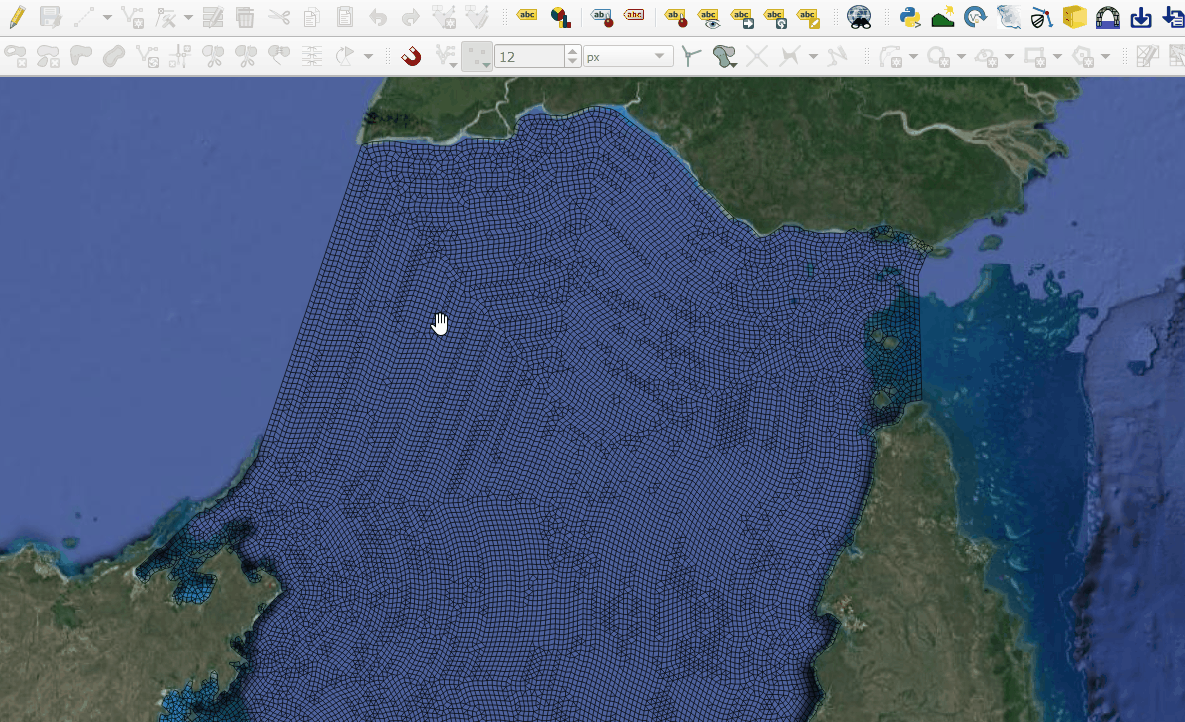
Figure 2: Digitising the location of boundary conditions in GIS.
Get Tide currently utilises tidal constituents from the FES2014 global astronomical tide model developed by Aviso+ (Noveltis, Legos and CLS, 2014), however other tidal datasets can be requested for inclusion. Water level data is extracted for each nodestring (Figure 3), and Get Tide produces a boundary condition control file (Figure 4).
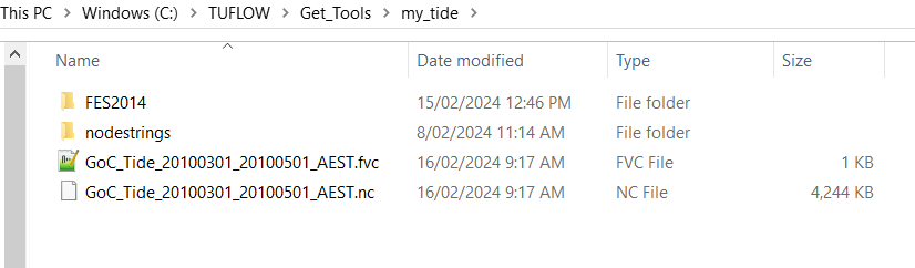
Figure 3: Get Tide outputs.
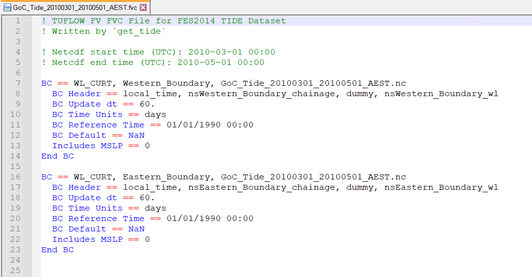
Figure 4: Get Tide output boundary condition fvc file.
To review Get Tide generated boundary data, Python’s Xarray module (automatically installed as part of the TUFLOW FV Python Toolbox) can be utilised to extract timeseries (Figure 5), long section plots, or to interrogate the raw data. This process is demonstrated within the Get Tide Wiki Tutorial.
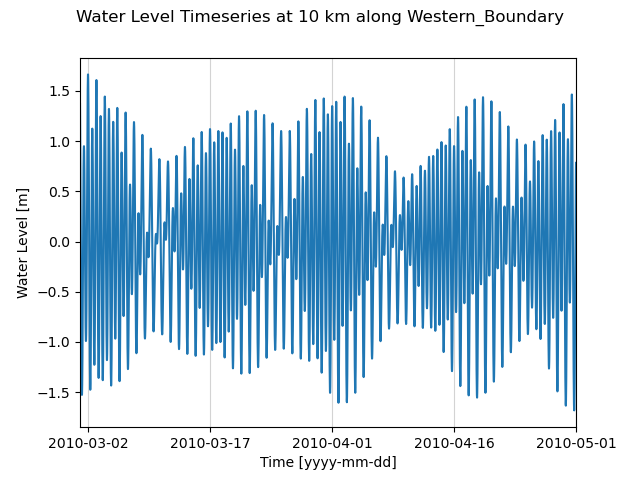
Figure 5: Water level time series on the Western Boundary via TUFLOW FV's Python Toolbox.
The Get Atmos tool enables the download of selected atmospheric model data such as wind speed, mean sea level pressure, air temperature, relative humidity, incoming solar and outgoing longwave radiation, cloud cover and precipitation from ECMWF's ERA5 (Copernicus Climate Change Service, 2023), NCAR’s CFSR and (CFSv2) (Saha, S., et al., 2011), or the Australian Bureau of Meteorology's BARRA Reanalysis (2019). This data is then saved as a NetCDF file in a user defined location (Figure 6), alongside a template control file containing the TUFLOW FV command blocks for atmospheric boundary conditions (Figure 7).
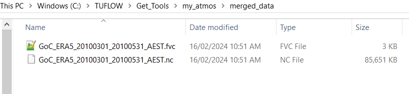
Figure 6: Get Atmos outputs.
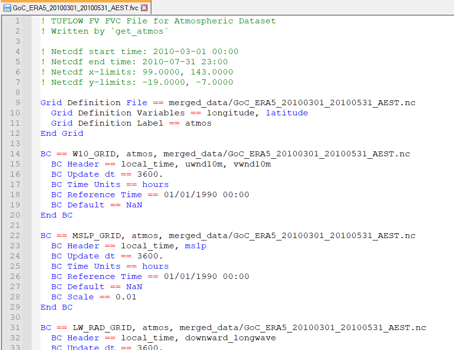
Figure 7: Get Atmos output boundary condition fvc file.
To check these boundary conditions, the TUFLOW Viewer QGIS Plugin can be used to read the NetCDF directly for easy visualisation. Figure 8 below shows a spatial map and time series of wind speed.
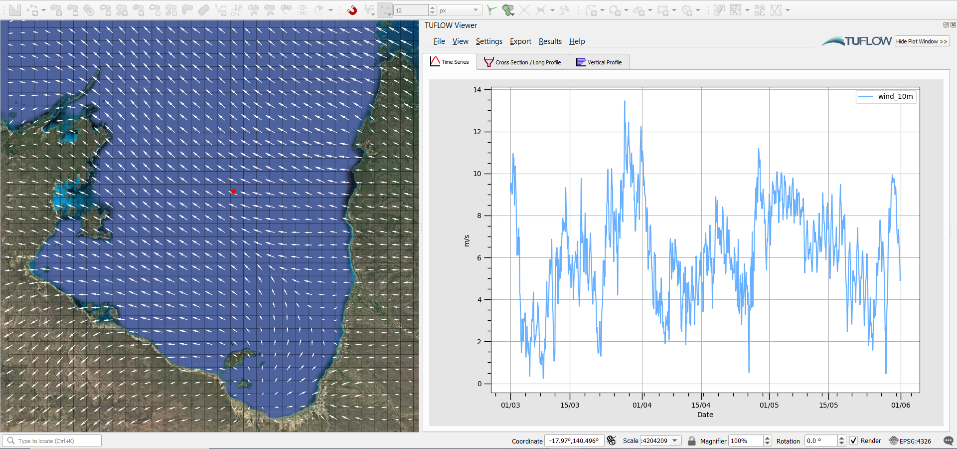
Figure 8: Inspecting Get Atmos dataset output using the TUFLOW Viewer QGIS plugin.
To learn more about using the Get Atmos Toolset please check out the Get Atmos Wiki Page.
The Get Ocean tool is used to apply ocean circulation model boundary conditions to a coastal model. Get Ocean downloads and processes HYCOM (GODAE, 2009) ocean data, including mean sea level surface anomaly, 3D ocean currents, 3D distribution of ocean salinity, and 3D distribution of ocean temperature.
Similarly to the Get Atmos tool, the saved data location can be specified (Figure 9), and a boundary conditions fvc file will automatically be produced (Figure 10). The fvc file requires only minor user input additions before it is ready to be included in a model.
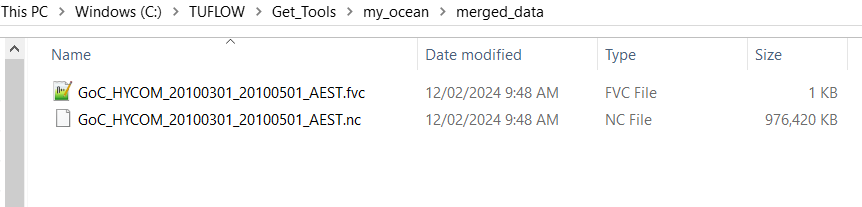
Figure 9: Get Ocean outputs.
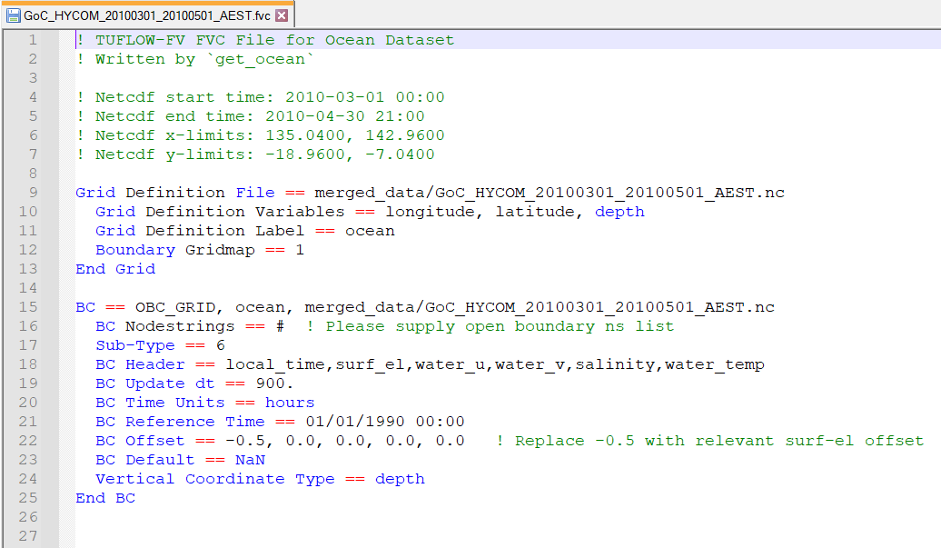
Figure 10: Get Ocean output boundary condition fvc file.
A plan view and 3D long section of TUFLOW FV model results driven by HYCOM boundary data is provided in Figure 11. These plots can be readily generated using the TUFLOW Plugin for QGIS and are excellent in helping check your boundary condition and model configuration in an interactive manner.
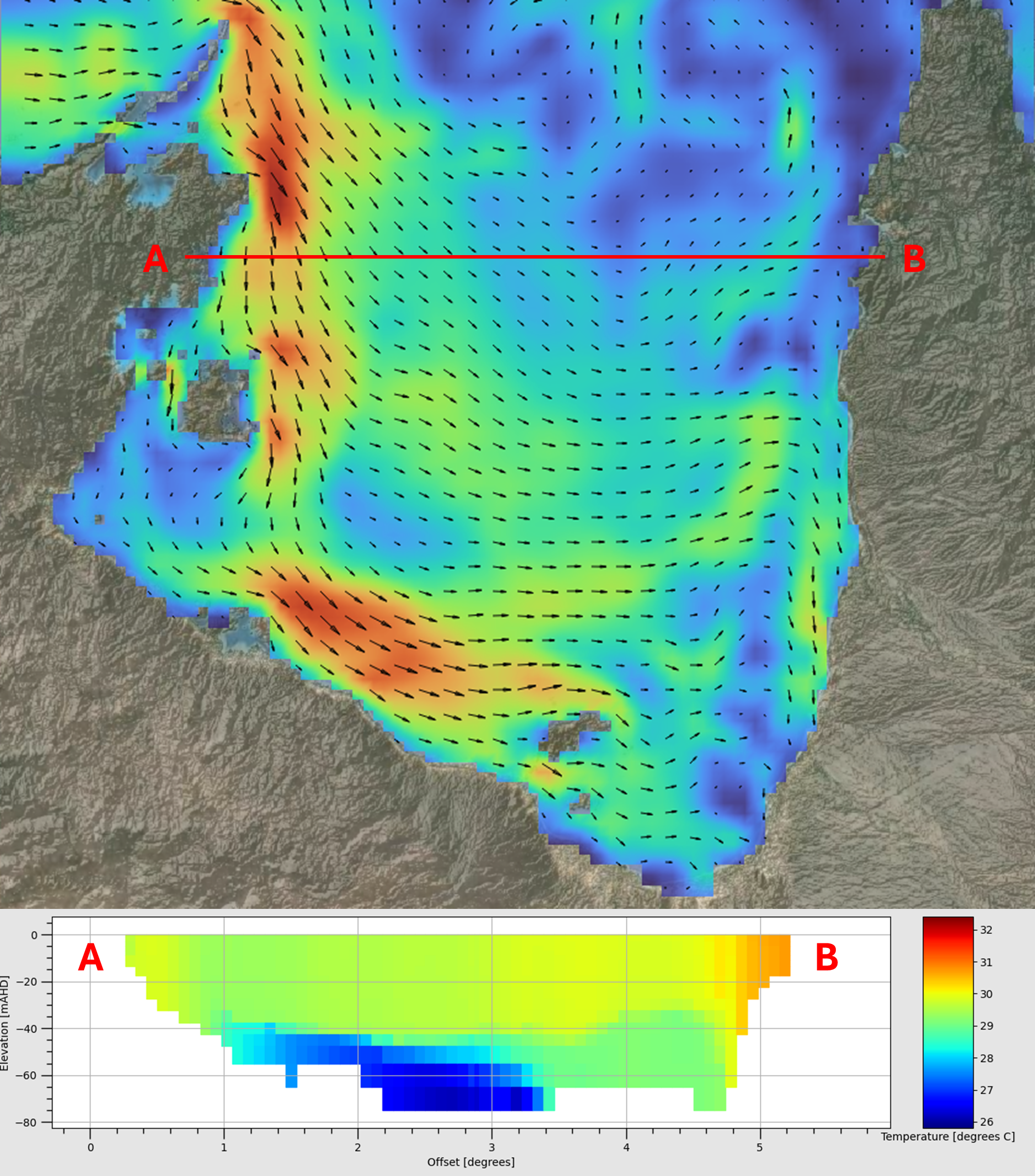
Figure 11: Get Ocean output boundary conditions. The upper plan view shows surface velocity and the bottom image a 3D temperature long section between Point A and Point B. Note the region of cooler water underlaying the warmer surface water between chainages 1 and 3 degrees of longitude.
To learn more about using the Get Ocean Toolset please check out the Get Ocean Wiki Page.
The Get Tide, Get Atmos and Get Ocean Tools provide a standardised method to download and setup tide, meteorological and ocean boundary conditions for TUFLOW FV. They provide compatible inputs to our QGIS TUFLOW Viewer Plugin and TUFLOW FV's Python Toolbox. We recommend the use of these tools when building TUFLOW FV models because they speed up workflows and provide efficient access to post processing tools.
We hope that the new trio of Get Tools simplify the process of constructing boundary conditions for you. Happy modelling from the TUFLOW Team!
Australian Bureau of Meteorology (2019). BARRA Product suite (Bureau of Meteorology Atmospheric high-resolution Regional Reanalysis for Australia).
Copernicus Climate Change Service (2023). ERA5 hourly data on single levels from 1940 to present. Copernicus Climate Change Service (C3S) Climate Data Store (CDS), DOI: 10.24381/cds.adbb2d47
Noveltis, Legos and CLS (2014). FES (Finite Element Solution) -Global Tide (FES2014). AVISO+ Satellite Altimetry Data.
Saha, S., et al. (2011), updated monthly. NCEP Climate Forecast System Version 2 (CFSv2) Selected Hourly Time-Series Products. Research Data Archive at the National Center for Atmospheric Research, Computational and Information Systems Laboratory. https://doi.org/10.5065/D6N877VB.
U. S. Global Ocean Data Assimilation Experiment (GODAE) (2009). HYbrid Coordinate Ocean Model (HYCOM).
TUFLOW FV Python Toolbox Wiki Page
TUFLOW - Info
CATCH is a new add-on module for both TUFLOW HPC and TUFLOW FV. It enables constituent (e.g. sediment, nutrients, pollutants, pathogens) generation, transport and intervention / mitigation features in the catchment. It also automates boundary condition information transfer between TUFLOW HPC to TUFLOW FV for fully integrated catchment and 3D receiving water modelling. Click here to learn more.

TUFLOW - Info
Version control is an important part of any model build process. This article highlights the use of the Kart tool to provide an alternative to the traditional approach to spatial data version control within TUFLOW models, bringing with it some exciting features for reviewing changes.
TUFLOW - Info
12d Model and TUFLOW provides an excellent way of integrating what were historically siloed areas of responsibility for civil designers, flood modellers and client liaison. This example showcases how 12d Model - TUFLOW can help customers overcome their problems in design and flooding projects by providing the connectivity from concept through to construction.

TUFLOW - Info
A new version of PyTUFLOW has been released which extends the library's functionality from accessing 1D results to supporting 2D results as well as input side functions. This brings with exciting opportunities to programmatically interact with TUFLOW model build files.